
I still remember the first time I read about the Tour du Mont Blanc or TMB for short. Inspired by our first through hiking adventure on the Inca Trail, I was down a rabbit hole, reading about other epic multi-day hikes. Along with the “W” in Chilean Patagonia, the TMB shot right to the top of my list of day dream worthy destinations. I knew we had to do it someday, but, given that it’s recommended as an 11 day hike, it would have to wait until we could dedicate an entire 2-week vacation to it. Or so I thought…

Fast forward a few years, and we found ourselves living just an hour’s drive from the TMB trail. Our first summer living in Switzerland was a busy one, full of visitors, travel and exploration. An 11-day through hike wasn’t in the cards, but the more we visited nearby Chamonix, the more we realized that the TMB can be completed in an almost endless amount of ways. There are some who complete the UTMB, a trail race in which the fastest competitors complete the trail in just over 20 hours, and others who make their way around the Mont Blanc Massif using a combination of buses and chair lifts. So, with a holiday weekend looming in early September, we decided to try our luck at covering the 105 mile trail in 4-days.
We covered a lot of ground in those 4 days, so this post will be a doozy – read on if you want to know more about…
- The TMB trail in general
- Our Method (fastpacking)
- Our Route
- Day-by-Day breakdown of how it went
- Our gear list – what we brought with us
A little about the TMB:
- The 105 mile trail (with 40,000 feet of vertical ascent) makes a giant loop around Mont Blanc, Europe’s highest peak.
- The trail passes through 3 countries – France, Italy and Switzerland.
- The “traditional” TMB hike starts and ends in Les Houches, a small French village about 10 minute’s drive outside of Chamonix, and walks counter-clockwise toward Italy.
- There is an incredible network of mountain huts all along the trail, most of which offer a bed and half-board (dinner and breakfast) in their nightly rate. Be sure to book in advance – many of the best huts are full during the summer season.
Our Method:
In order to cover the distance in 4-days, we’d have to move at a pretty good pace. This meant keeping our pack’s light was essential. In fact, we made it our goal to carry only one small hydration backpack each. These bags are made for trail running, and are built like vests, so they hug your body and minimize bounce. This meant we could run sections of the trail without feeling encumbered by our gear. In general our goal was to hike the uphills, and run the downhill and flat sections.
Our Route:
Full disclosure, we did not actually complete the full loop. During the summer, we had hiked and run the trails between Argentiere, Chamonix and Les Houches many times already, and quite frankly, the motivation to add them on at the beginning or end of the already long trail just wasn’t there. So, we decided to depart from Les Houches, and end our hike at a friend’s house in Argentiere. In total we would cover 96 miles.
We also failed to heed the tip I offered above about booking huts in advance, thinking mistakenly that September would be a lower month and therefore easier to find last minute accommodation. Because most of the huts we wanted to stop at were full, we had to alter our route a little bit to ensure we could find hotels in 3 of the bigger towns along the trail.

Day 1: Les Houches to Les Contamines
Day 1 was, by far, our shortest day on the trail. This ended up being a good thing, as it was also the only day we had to deal with afternoon storms. We set out in the morning from Les Houches, after a quick stop into the bakery for some Pain a Chocolates. Fuel in tow, we headed into the unknown. The trail between Les Houches and Contamines is less remote, and winds through many small villages and even through a few backyards. There were plenty of places to re-fill water, and some pretty views despite a moody sky. We made good time, covering the 11.4 mile distance in about 3 hours, and missing most of the storm. We checked into our hotel, grabbed some snacks and food for breakfast at the grocery, and enjoyed a relaxing night. Day 2, which would be nearly triple the distance, was looming.


Day 2: Les Contamines to Courmayeur
On Day 2, it was time to get serious. We had a border to cross, and 30 miles to cover. This day would also have the most vertical climbing. We set out in darkness, a bit before 7AM, and continued in a thick fog as the sun rose. The first 7 miles took us up, up and up, as we ascended to the trails highest point. Fortunately, as we began to descend back into the valley, the fog lifted and the views did not disappoint. We passed a few herds of sheep and cows, as we made our way back down to the valley floor. Unfortunately, around this time, Matt’s stomach also started to go downhill.


Unlike Day 1, the stretch of trail between Les Contamines and Courmayeur is relatively remote. There are a few huts along the way, but water fountains are much more scarce and you don’t really pass through any towns. This makes for beautiful scenery, but not a lot of bail out options for someone who suddenly finds themselves with a bad stomach. For the next 10 miles, we trudged along. I tried my best to keep Matt’s spirits high, and he did his best to put one foot in front of the other between breaks to puke off the side of the mountain. It wasn’t pretty, but by mid-afternoon, we made it across the Italian border and to the Elisabetta hut.


With the hours until grocery stores would close dwindling, we decided to split up for the final 10 miles. I left Matt at the hut with a sprite, and took off to cover the final stretch. After some flat running on the valley floor, the trail turned upward one last time. The struggle was real, but fortunately the views and the thought of a giant pizza kept me moving. I arrived in Courmayeur with the sun shining, checked into our hotel, and hustled over to the grocery store where I proceeded to purchase an obscene amount of snacks. Matt’s stomach had started to rebound during the final few miles, and we enjoyed an evening of pizza in bed and views of Mont Blanc from our balcony.


Day 3: Courmayeur to Orsieres
What’s better after a 30 mile day than another 30 mile day? Don’t answer that. Fortunately, Matt’s stomach bug seemed to have been temporary, so we only had sore legs to contend with as we set off toward Switzerland. This day was my favorite in terms of views. The sun was shining, and as soon as we made it above the tree line coming out of Courmayeur, we were rewarded with some of the most incredible scenery all along the trail. After the initial climb, the trail flattened out for awhile, and we jogged our way along a rolling trail that led to the Bonatti hut. If you have the chance, I highly recommend making a stop here. The hut was beautiful, clean and offered some of amazing views. We grabbed a blueberry tart, and espresso and a citrus soda (I ordered a a Sprite, the waiter pointed to the soda and I said “oh, it’s the same?”, to which he replied, “It’s better.”)


After a relaxing mid-morning break, it was time to hit the trail again. It was smooth sailing across a nice flat section of trail, until we hit a road block – an Italian shepherd moving his cows right along the main trail. After a failed attempt to pass them, we spent about 20 minutes trailing behind them, while the shepherd chatted to us in Italian, not seeming to care that we could neither understand nor respond to anything he said.
After making it around the cow-train, it was time to head back up. While the total elevation gain was less than Day 2, there was still one more big climb between us and the Swiss border. Perhaps more demoralizing than the climb itself, was the fact that it came off the back of a long descent back to our starting elevation. Such is the TMB.
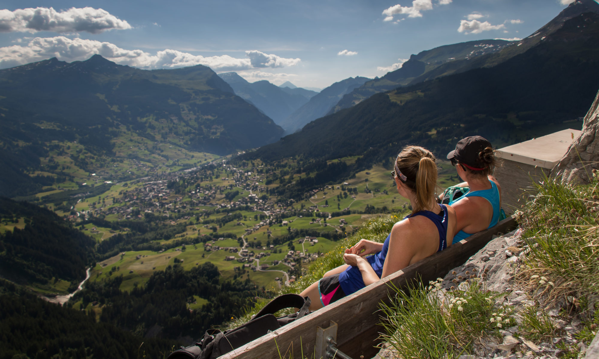
The trail up to the Grand Col Ferret, the high point of Day 3, was much busier than previous sections and seemed to be frequented mostly by day hikers. When we reached the top, it was easy to see why this was such a popular trail, with views in every direction. We took a short break to refuel and take in the views, before starting another long descent into Switzerland. The downhill was gradual, and we were able to make good time running past a few more huts, and startling a few hikers (“They need bells on them!”).


From there we passed through the Swiss town of La Fouly, where we split up again for the final, flat, 7 miles. Despite making good time jogging through the mostly flat trails and some stretches of road, when I arrived at our hotel in Orsieres, Switzerland at 5:02 PM, I was informed by the man working the check in that all the grocery stores had closed for the weekend at 5PM. We were back in Switzerland after all.
It’s worth saying that Orsieres is not actually on the TMB route. Because hotels in Champex-Lac, the main town along the actual route, were sold out, we had to divert slightly into Orsieres. If possible, I’d recommend using Champex-Lac as your stopping point. The town seemed a bit more lively, has better views and is right along the route.
After wandering around in search of a restaurant where we could get something quick, we eventually ended up back at our hotel, where we sat alone in the hotel’s restaurant, scarfed down 2 more pizzas and convinced the hotel staff to leave a few croissants out for us to take in the morning given we had depleted our snack reserves and breakfast wasn’t served until 9AM.
Day 4: Orsieres to Argentiere
The final day. 18 miles stood between us and the end of our tour. Or was it 24 miles? Details…
The day started with a long slog up to Champex-Lac, during which we cursed ourselves for not booking a hotel earlier and thus avoiding this early morning climb to get back on the trail. Once we made it to town, though, the bakeries were open so we grabbed some pastries and continued along our way.
From here, we were rewarded with more climbing and more views. After a relatively steep section, we were above the tree line and the next several miles were pretty flat, and skirted us around the side of the Massif, giving us expansive views of the Swiss canton of Valais. We descended into the town of Trient, famous for it’s pink church, stopped to refill our water, and readied ourselves for the final climb of the tour.


We made it to the top of the climb with high spirits, but it was on the descent that things began to unravel a bit. Our map of today’s route showed 18 miles and so far, our estimates had been pretty spot on. As we set out this morning, though, I had a feeling we might have mis-calculated something based on the segments we had to cover. Unfortunately, 17 miles in, we realized my feeling was correct as we were still 7 miles from our final destination.
While I tried to rally us by reminding Matt that the last segment was downhill and flat (we could be done in no time if we jogged!), his legs weren’t having it. So, miles 88-95 were a nice, slow victory walk across the valley floor. It might not have been the ending we wanted, but after deciding to do the trail in 4 days on a relative whim, it was probably the ending we deserved. All in all, despite some physical pain along the way, we stepped off the trail feeling satisfied and energized by the experience.
While the 4-day version of the trail might not be for everyone, I would highly recommend this hike. There are so many ways to piece together the segments (or just do a portion of the trail) so it’s easy to adjust based on the amount of time you have and your level of enthusiasm for long hikes.
Thinking of planning your own tour? Start by picking up a copy of The Tour of Mont Blanc: Complete two-way trekking guide, which is probably the most exhaustive resource on the trail. Feel free to leave me your questions in the comments below as well.
Our Gear
While building up our fitness level to complete the trail was one thing, perhaps the biggest challenge was pairing down our gear so we could be as fast and light as possible. Here’s what we brought on the tour:
Gear
- Salomon hydration vests – I brought the 12L Adv-Skin vest, and Matt carried the 15L version
- Soft-flask water bottles and/or hydration bladder
- Black Diamond Trekking Poles
*Clothing
- 2 pairs of running shorts
- 2 dri-fit t-shirts
- 2 pair lightweight trail running socks
- 1 pair of running tights (we had great weather, so I never wore these)
- 2 sports bras
- 4 pair underwear
- 1 long sleeve baselayer
- 1 pair lightweight pants (these pants are my go-to for travel, and throwing in a bag just in case!)
- 1 lightweight running rain jacket
- 1 puffy jacket (could have gotten by without this, but was helpful for night time)
- Trail running shoes – my current favorite are the La Sportiva Akasha’s
Misc
- 1-day’s worth of snacks (you can stop at grocery stores along the way to re-stock)
- contact lenses & glasses
- sunscreen
- small travel brush
- headband
- buff
- sunglasses
- chapstick
- phone
- wallet
- ziplock bags – to carry snacks, organize/compress clothing, and keep things dry if it rains
- deodorant
- toothbrush/paste
- running gloves
*clothing that I brought, Matt brought very similar items, minus the puffy jacket, sports bras and tights
Happy Trails!